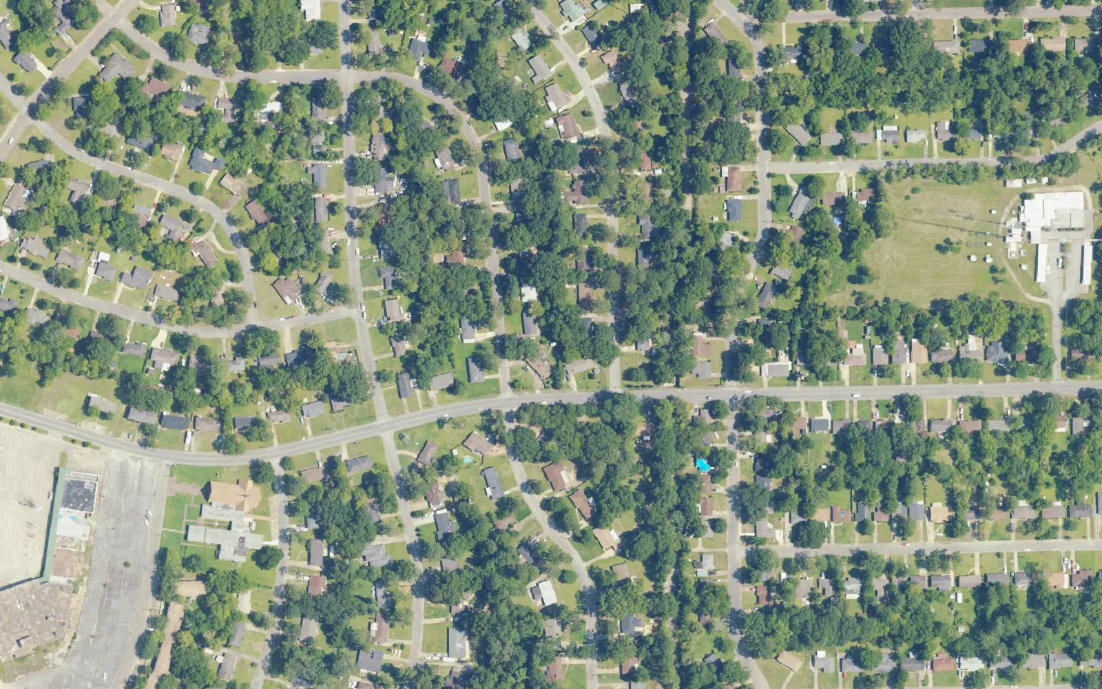
Normandale, in south-central Montgomery near East South Boulevard, is in ZIP 36111, where Zillow's typical home value was $152,700 in September 2026.
Last checked Oct. 17, 2026. Sources: the City of Montgomery’s Neighborhood Services map layer and ZIP code layer, the Envision Montgomery 2040 comprehensive plan (PDF), the city’s parks directory, the Montgomery Public Schools school zone search, the state’s report card, Zillow Research, The M and OpenStreetMap.
Normandale is a neighborhood in south-central Montgomery, south of Cloverdale and north of East South Boulevard. OpenStreetMap places Normandale there, and the city’s Neighborhood Services map assigns the area to the Normandale Neighborhood Association. The city’s Envision Montgomery 2040 plan says Montgomery had a “subdivision boom” between 1951 and 1954, “with sixty new subdivisions created in this period alone,” and that Cloverland Mall and Normandale Mall “were constructed in the same era as the areas first ‘shopping centers.’”
What this means for you
- Zoned high school: Carver High at every point we checked; the elementary zone is split.
- Home value: $152,700 in ZIP 36111 in September 2026, according to the Zillow Home Value Index.
- Nearest interstate exits: I-65 Exit 169 (Edgemont Avenue) and Exit 170 (Fairview Avenue), about 2 miles west in a straight line.
Part of our Montgomery neighborhoods guide.
Where it is
East Patton Avenue and Adrian Lane run through the neighborhood, by OpenStreetMap, with Norman Bridge Road, Narrow Lane Road, East Edgemont Avenue and East South Boulevard along or near its edges. Most of the association’s mapped area (96%) is in ZIP code 36111; a small piece on the west edge is in 36105, by the city’s ZIP code layer.
The city lists the Cloverdale Idlewild Neighborhood Association just to the north.
Schools
We checked 24 points across the neighborhood in the district’s school zone search on Oct. 17. Grades are from the state’s 2024-25 report card.
| Level | Zoned school | Points | 2024-25 grade |
|---|---|---|---|
| High | Carver High, 2001 W. Fairview Ave. | 24 of 24 | D (61) |
| Middle | Bellingrath Middle, 3350 S. Court St. | 24 of 24 | F (52) |
| Elementary | Davis Elementary, 3605 Rosa L. Parks Ave. | 14 of 24 (north and west) | D (63) |
| Elementary | Dannelly Elementary, 3425 Carter Hill Road | 10 of 24 (south and east) | C (76) |
Montgomery Public Schools as a whole earned a C (75). Because the elementary line runs through Normandale, enter an exact address in the zone search or call 334-223-6700. More in our schools guide.
Home values
The typical home value in ZIP 36111 was $152,700 in September 2026, up 2.1% from $149,582 in September 2025, according to the Zillow Home Value Index. The index is a modeled typical value for the middle third of homes, not a sale price, and ZIP 36111 covers neighborhoods well beyond Normandale. The citywide figure was $149,943, up 1.7%. More in our home prices guide.
Parks and trails
The city’s parks directory lists no park inside the association’s mapped area. The nearest, about a third of a mile north on Cloverdale Road:
- Audubon park, 3174 Cloverdale Road, with ball fields and a playground
- Cloverdale Road Park, 3124 Cloverdale Road, a median park with a playground and trail
More in our parks and trails guide.
Getting around
- Interstates: the nearest exits are I-65 Exit 169 (Edgemont Avenue), I-65 Exit 170 (Fairview Avenue) and I-85 Exit 2 (Forest Avenue and Mulberry Street), each about 2 miles away in a straight line, by OpenStreetMap’s ramp signs.
- City Hall, 103 N. Perry St., is about 4 miles from the middle of the area by road.
- Montgomery Regional Airport is about 11 miles by road. Both are road distances measured on the OpenStreetMap network with the OSRM routing engine, not drive times.
- Buses: three routes of The M run through or along the neighborhood: 3 Montgomery Commons, 11 Rosa Parks/South Blvd. and 17 Boulevard.
More in our getting around guide.
Neighborhood association
The city’s neighborhood directory lists the Normandale Neighborhood Association for this area. Neighborhood Services is at 334-625-3422; city service requests go to 311 at 334-625-4636.
Groceries and everyday stores
OpenStreetMap maps no supermarket or pharmacy inside the neighborhood. The nearest it shows:
- Walgreens, East South Boulevard, about 1.5 miles east
How we drew this area
The edges are the Normandale Neighborhood Association area in the city’s Neighborhood Services map layer; OpenStreetMap places a Normandale place name inside it. ZIP shares come from the city’s ZIP code layer and school zones from 24 points inside the edges. Store, exit and bus route data are © OpenStreetMap contributors. The aerial photo is from the U.S. Department of Agriculture’s National Agriculture Imagery Program.
Frequently asked questions
What schools is Normandale in Montgomery zoned for?
Bellingrath Middle and Carver High at every point we checked. The elementary zone is split: Davis Elementary for the northern and western part and Dannelly Elementary for the southern and eastern part, in the Montgomery Public Schools zone search on Oct. 17, 2026.
What ZIP code is Normandale in?
Mostly 36111, with a small piece on the west edge in 36105, by the city’s ZIP code map layer.
What is the typical home value in Normandale?
Zillow’s index for ZIP code 36111 was $152,700 in September 2026, up 2.1% from a year earlier. It is a modeled value for the whole ZIP code, not a sale price.
What does the city plan say about Normandale’s history?
The city’s Envision Montgomery 2040 plan says Montgomery had a subdivision boom between 1951 and 1954, with 60 new subdivisions, and that Normandale Mall was built in that era as one of the area’s first shopping centers.
Have your say