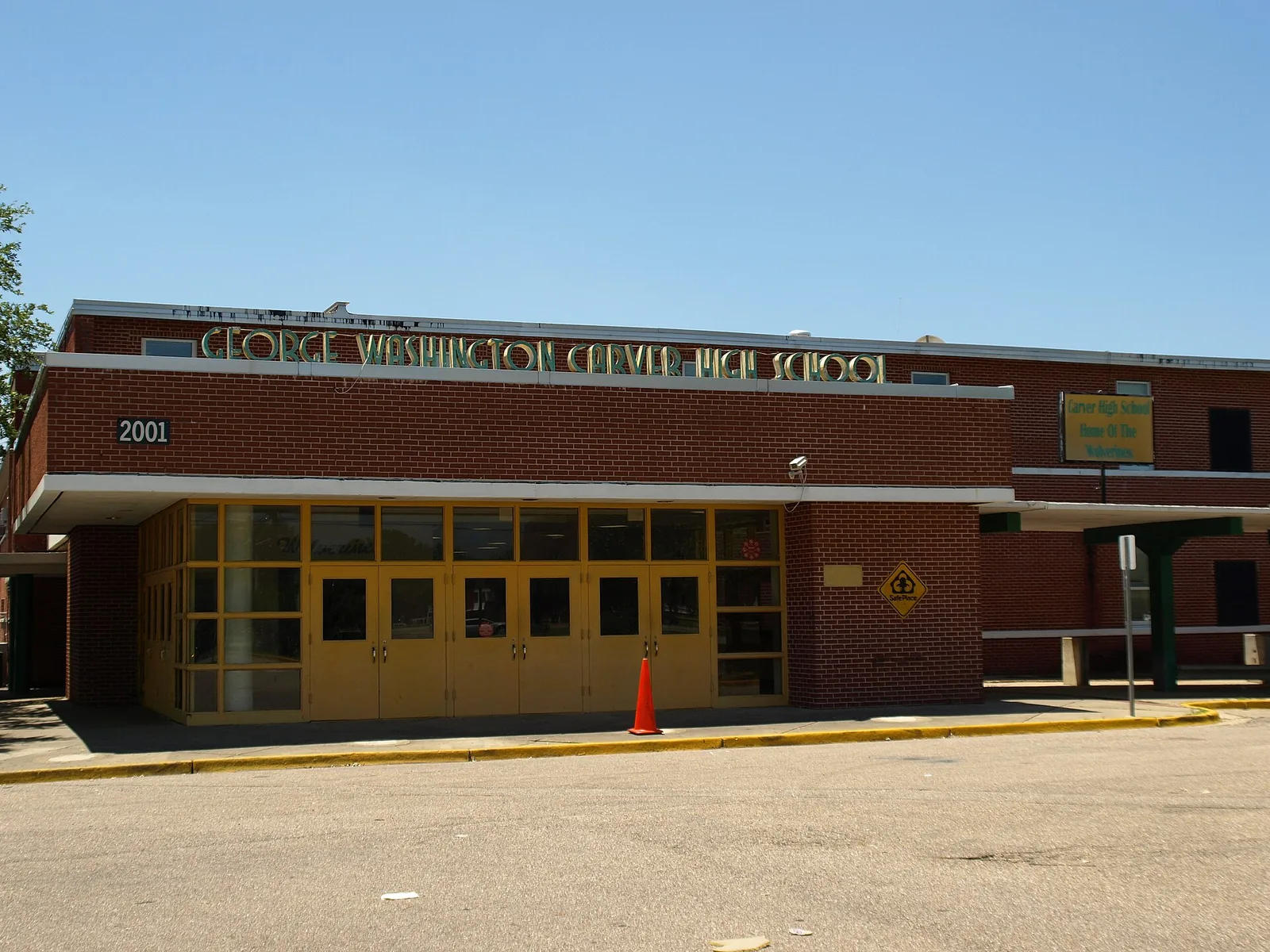
Washington Park, in west Montgomery off I-65 at Fairview Avenue, is in ZIP 36108 and zoned for Nixon Elementary, Southlawn Middle and Carver High.
Last checked Oct. 17, 2026. Sources: the City of Montgomery’s Neighborhood Services map layer and ZIP code layer, the city’s parks directory, the Montgomery Public Schools school zone search, the state’s report card, Zillow Research, The M and OpenStreetMap.
Washington Park is a neighborhood in west Montgomery, just west of I-65 along Mobile Road, a little over 2 miles from City Hall by road. OpenStreetMap places Washington Park there, and the city’s Neighborhood Services map assigns the area to the Washington Park-Westcottville Association. The city’s park of the same name is at its west edge.
What this means for you
- Zoned high school: Carver High at every point we checked; it sits about 0.2 mile south of the neighborhood.
- Home value: $64,011 in ZIP 36108 in September 2026, according to the Zillow Home Value Index.
- Nearest interstate exit: I-65 Exit 170 (Fairview Avenue), under half a mile away in a straight line.
Part of our Montgomery neighborhoods guide.
Where it is
Oak Street, Early Street and Mobile Road run through the neighborhood, by OpenStreetMap, with Hill Street and West Fairview Avenue along or near its edges. All of the association’s mapped area is in ZIP code 36108, by the city’s ZIP code layer.
The city’s directory lists a separate Greater Washington Park Neighborhood Association about two miles to the southwest; it is a different area. Other groups nearby include the Western Hills, Carver Park and Westwood Estates associations.
Schools
We checked 25 points across the neighborhood in the district’s school zone search on Oct. 17. Grades are from the state’s 2024-25 report card.
| Level | Zoned school | Points | 2024-25 grade |
|---|---|---|---|
| High | Carver High, 2001 W. Fairview Ave. | 25 of 25 | D (61) |
| Middle | Southlawn Middle, 5333 Mobile Highway | 25 of 25 | F (55) |
| Elementary | Nixon Elementary, 1000 Edgar D. Nixon Ave. | 24 of 25 | C (70) |
| Elementary | Morris Elementary, 801 Hill St. | 1 of 25 | C (79) |
Montgomery Public Schools as a whole earned a C (75). Because the elementary zone line touches the neighborhood, check an exact address in the zone search or at 334-223-6700. More in our schools guide.
Home values
The typical home value in ZIP 36108 was $64,011 in September 2026, up 8.1% from $59,227 in September 2025, according to the Zillow Home Value Index. The index is a modeled typical value for the middle third of homes, not a sale price, and ZIP 36108 covers much of west and southwest Montgomery. The citywide figure was $149,943, up 1.7%. More in our home prices guide.
Parks and trails
From the city’s parks directory:
- Washington Park, 2330 Dorothy St., at the neighborhood’s west edge
- Western Hills Park, 2325 Clarence Lee Drive, about a quarter mile away
OpenStreetMap also maps Fairview Environmental Park close by, about 0.15 mile from the neighborhood’s edge. More in our parks and trails guide.
Getting around
- Interstates: the nearest exits are I-65 Exit 170 (Fairview Avenue) and Exit 169 (Edgemont Avenue); I-85 Exit 1 (Court Street and Union Street) is about a mile northeast. Exit signs are from OpenStreetMap’s ramp data.
- City Hall, 103 N. Perry St., is about 2.4 miles from the middle of the area by road.
- Montgomery Regional Airport is about 10 miles by road. Both are road distances measured on the OpenStreetMap network with the OSRM routing engine, not drive times.
- Buses: three routes of The M run through or along the neighborhood: 3 Montgomery Commons, 12 Smiley Court Gibbs Village and 16 East-West Connector. Routes 3, 12 and 16 all use the Fairview Transfer Center.
More in our getting around guide.
Neighborhood association
The city’s neighborhood directory lists the Washington Park-Westcottville Association for this area. Neighborhood Services is at 334-625-3422; city service requests go to 311 at 334-625-4636.
Groceries and everyday stores
OpenStreetMap maps no supermarket inside the neighborhood. Nearby it shows:
- CVS Pharmacy, West Fairview Avenue, about 0.3 mile southeast
- Bertha P. Williams Library, a branch of the city-county library, 1276 Rosa Parks Ave., about 0.2 mile east
How we drew this area
The edges are the Washington Park-Westcottville Association area in the city’s Neighborhood Services map layer; OpenStreetMap places a Washington Park place name inside it. ZIP shares come from the city’s ZIP code layer and school zones from 25 points inside the edges. Store, exit and bus route data are © OpenStreetMap contributors.
Frequently asked questions
What schools is Washington Park in Montgomery zoned for?
Carver High and Southlawn Middle at every point we checked, and Nixon Elementary at 24 of 25 points; one point on the edge was zoned for Morris Elementary, in the Montgomery Public Schools zone search on Oct. 17, 2026.
What is the nearest interstate exit to Washington Park?
I-65 Exit 170, Fairview Avenue, under half a mile from the middle of the neighborhood in a straight line. Exit 169, Edgemont Avenue, is next to the south.
What is the typical home value in Washington Park?
Zillow’s index for ZIP code 36108 was $64,011 in September 2026, up 8.1% from a year earlier. It is a modeled value for the whole ZIP code, not a sale price.
Is there a library near Washington Park?
Yes. OpenStreetMap places the city-county library’s Bertha P. Williams branch at 1276 Rosa Parks Ave., about 0.2 mile from the neighborhood.
Have your say